
LOADING


Brief History of Eastway Gardens
The early years - Bannermount Subdivision
In the post-war era, the National Capital Commission wanted to abandon many of the rail lines as part of their efforts to beautify the city. These plans included the closure of many of the existing rail lines throughout the city. The section of the Sussex Sub from Beechwood Avenue to Sussex was last used on June 15, 1964, and the section from Beechwood to Hurdman Junction on June 15, 1966. These sections were later used to form the Vanier Parkway between Highway 417 and Beechwood.
TAP ON MAP BELOW TO ENLARGE


In 1911, Nicholas J. Tremblay’s property in Gloucester Township was registered as the new subdivision of Bannermount.
(View/download high resolution scan of the original map PDF)
Bannermount becomes Eastway Gardens
Homes on Avenues N and O were built for the employees of Morrison Lamothe Bakery. A distribution warehouse was located on nearby St. Laurent Blvd. The warehouse closed in 1967 and was repurposed as the Canada Science and Technology Museum.
Many of the small apartment buildings and houses built in the district during the 1950s remain. Others were demolished for various reasons or converted to businesses. Avenues N through U still boast a good concentration of original homes.
Avenues A through D were removed to accommodate the Alta Vista Drive-Queensway interchange, built in 1960 as part of the King's Highway (read about how construction of the "Kings Highway 417" impacted Eastway Gardens. Additionally, Avenue M was replaced by Belfast Road, connecting the industrial park north of the Queensway to the one south. By 1967, the newly relocated Via Rail train station necessitated the removal of Avenues E through H.
Eastway Gardens Today
Then developers moved in and bought the lots in phases. In the late 1990s, townhomes appeared on Avenues O and P where the bush had been. According to residents, many of these new townhouses were abandoned before completion. Afterward, other developers and private contractors picked up where the original companies left off. The foundations on some lots were completely demolished and the houses were rebuilt. Most abandoned structures, however, were completed from the state in which they were left.

Cecil Morrison Park was named after the president of Morrison-Lamothe Bakery. Photo courtesy of Shakespeare in Ottawa (1867-2017).

By Peter Hum
Published May 26, 2021
Ottawa Citizen
TCU Development Corp. recently bought the restaurant and a neighbouring property from its owner, and will tear them down before building a six-storey residential building that will consist of more than 70 one- and two-bedroom units, plus commercial space on its ground floor.
The White Horse opened in 1959, said Rachel. Its first owner was the cousin of her husband, and he chose the business’s name because 'he was always dreaming of buying a white horse, but he couldn’t afford it,' she said.
An isolated small business in an industrial area near the Ottawa Train Station and Tremblay LRT Station, the eatery is like a throwback to an earlier time given its history, menu and decor…"

The White Horse Restaurant, 300 Tremblay Road, opened in 1959 and closed in 2021.
Photo courtesy Wikipedia
Attribution: Earl Andrew, CC BY-SA 4.0

MATA - 300 Tremblay Road - 6 storey rental apartment building on the site of the former White Horse Restaurant opened for occupancy in January, 2026.
Photo courtesy Pomerleau


1959 — Construction of the new Ottawa Queensway at the Avenue "M" Overpass (today's Belfast Road)
(Ontario Highway 417 Photographs-
Page 1 - History of Ontario's Kings Highway)


1959 — "Traffic Director Thor Nielsen announced that the Alia Vista-Queensway interchange will be partly opened to traffic tomorrow after the morning rush period. The effect will be to form a direct link between Hurdman’s Bridge and Alta Vista Drive. Mr. Nielsen said that the complete Interchange will not be ready until well into next year when Queensway construction has progressed further to the east."
(The Ottawa Journal Archives Page 5 Dec 23, 1959


1960 — Aerial view of the Alta Vista Drive Interchange (today's Vanier Parkway) on the Ottawa Queensway, facing east. It is believed that this photo was taken shortly before the new highway opened to traffic on November 25, 1960. This aerial photo shows the bizarre original ramp configuration at this interchange. As originally constructed, the ramps at this interchange were spliced with connections to and from adjacent Tremblay Road. The interchange was extensively reconfigured over the years and now looks very different today. The direct ramp connection from Tremblay Road to the westbound Ottawa Queensway was demolished many years ago.
(Ontario Highway 417 Photographs-
Page 1 - History of Ontario's Kings Highway)


1960 — Plan showing the eastern approach (Stage 1) of the Ottawa Queensway between Montreal Road (Old Hwy 17) and Hurdman Bridge over the Rideau River. This 6.5 mile section of the Ottawa Queensway was officially opened to traffic on November 25, 1960.
(Ontario Highway 417 Photographs-
Page 1 - History of Ontario's Kings Highway)


1961 — Facing west along the Ottawa Queensway towards the Alta Vista Drive (today's Vanier Parkway) Overpass from Tremblay Road in 1961.
(Ontario Highway 417 Photographs-
Page 1 - History of Ontario's Kings Highway)


1966 — Completed final 3/4-mile section of the Ottawa Queensway (Stage 4) at the Alta Vista Drive Interchange and Hurdman Bridge
(Ontario Highway 417 Photographs-
Page 1 - History of Ontario's Kings Highway)

Morrison Lamothe was a historic Ottawa-based bakery founded by brothers-in-law Cecil Morrison and Richard Lamothe in 1933, with its primary, well-known location at 95 Echo Drive in Old Ottawa East. Other locations included a warehouse distribution facility on St. Laurent Boulevard and a return store on Montcalm Street.
Homes on Avenues N and O were purpose built to house Morrison Lamothe Bakery employees. Later, a nearby park developed by the City was named after Cecil Morrison, the bakery's president.
The company transitioned from a retail bakery to a major frozen food manufacturer by the 1960s. Cecil Morrison’s daughters, Jean Pigott and Grete Hale—well-known figures in Ottawa—led the company through the late 1960s and 70s. But as demand for traditional baked goods declined, the bakery side of the business was sold in 1979 and the Echo Drive plant closed, marking the end of large-scale commercial baking in Old Ottawa East.
The Morrison Lamothe warehouse located on St. Laurent Blvd. was apparently little used and closed in 1967. That's when the Canada Science and Technology Museum opened in the former warehouse in what was supposed to be a temporary location. The museum, however, operated in this industrial space for nearly 50 years until closing in 2014 due to mold and structural issues before being rebuilt.
Cecil Morrison Park
Cecil Morrison Park at the east end of Eastway Gardens is a City-owned facility named after Cecil Morrison, president of Morrison-Lamothe Bakery, whose employees were housed on Avenues N and O. The park offers a wading pool, tennis and basketball courts, and other amenities for residents. The park is very busy during the summer. In the winter, volunteers from the Residents Association work hard to maintain a skating rink where kids skate and play hockey after school.
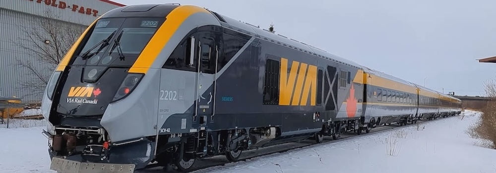
• Via Rail train - Keira Clarke, CC BY 4.0
.jpg)
• OC Transpo Train LRV - By *Youngjin - Own work, CC BY-SA 3.0
- ../../resources/green.jpg